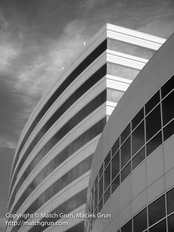
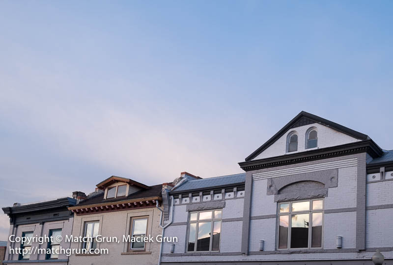
After looking through some images made during the week, I decided to pick images with a theme of architecture. At Arapahoe Station, there are three buildings that were completed in the last decade or so. In this image, I included the oldest and youngest of these buildings. I like the mix of curved and straight lines of these two buildings. For most of the week we had some high altitude clouds that provide a nice texture to the sky in this monochrome image.
Station Buildings, Arapahoe Station.
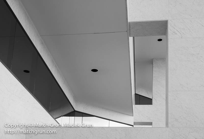
Where I work, the building surfaces are covered with marble. The building has some really angular features that create some interesting images.
Marble Arches.
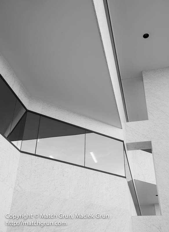
Here is another image that I made to include some different angles.
Marble Boxes And Windows.
This image reminds me of some of the futuristic sea-going ship designs, where the angled surfaces are designed to reflect away radar reflections. This is one building where I have made several images over the last few years. These images just need to be collected into a coherent folio, but that is a project for another day!
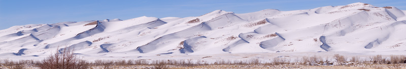
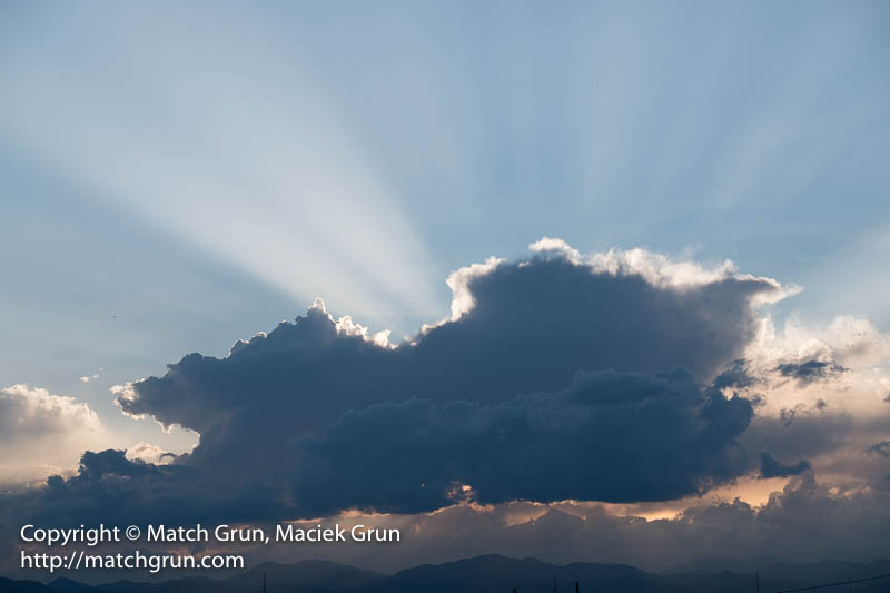
This last weekend was the first week of summer. Friday was the Summer Solstice. With the low temperatures over the weekend, it was more like a Winter Solstice! Anyway, we had plenty of overcast weather with rain at the weekend. Also, snow was forecast in the mountains.
Originally, I had planned to head up to Mt. Evans, but the road was closed — probably because of the weather and the wind. So I headed over the Guanella Pass. Heading up the pass from Georgetown, the road follows South Clear Creek. I stopped to make some images of the creek at a location where I found some orange gravels in the creek.
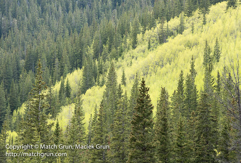
Here is an aspen forest, with fresh new green leaves, close to the location. Yes. No snow-storm and no creek!
Early Season Aspen Forest In Guanella Pass.
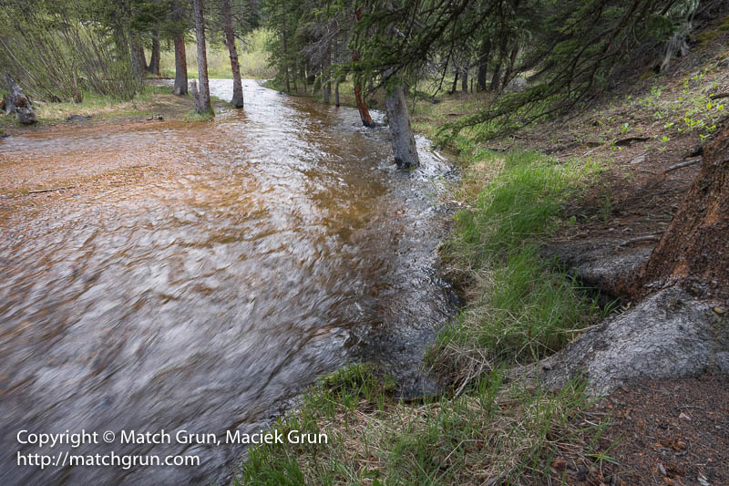
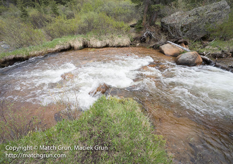
With all the snow that we have had this last year, the rivers were flowing strongly. This creek was no exception, with trees under water.
South Clear Creek With Orange Gravels.
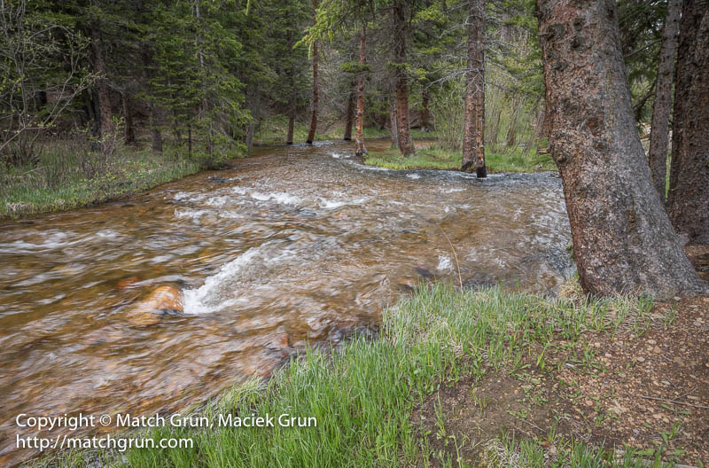
Above this spot, the creek splits into two forks.
Fork In The South Clear Creek, Guanella Pass.
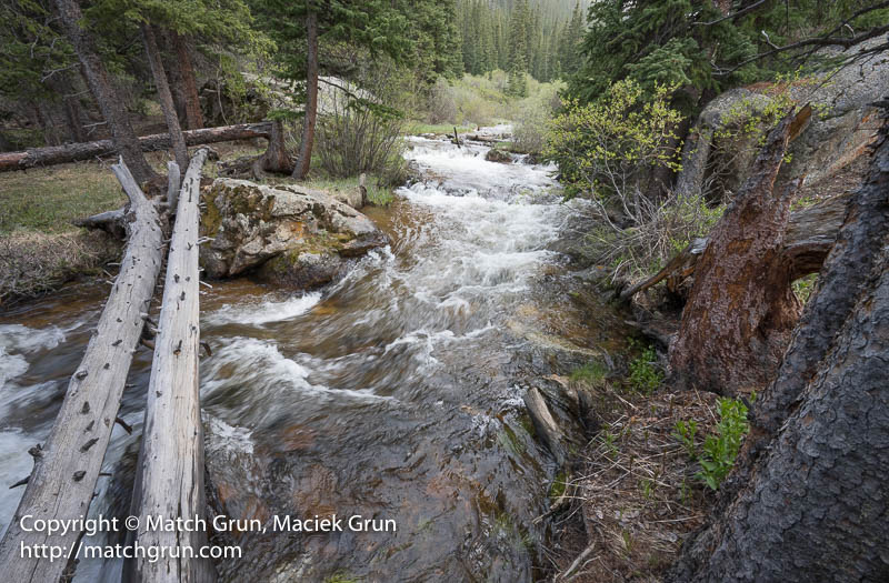
Heading farther up the pass, one can hear the waters rushing down the creek. I this log bridge close to some small waterfalls by the roadside.
Log Bridge Over South Clear Creek.
Farther upstream, the creek makes its way around a bend.
Bend In South Clear Creek.
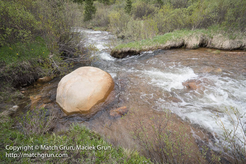
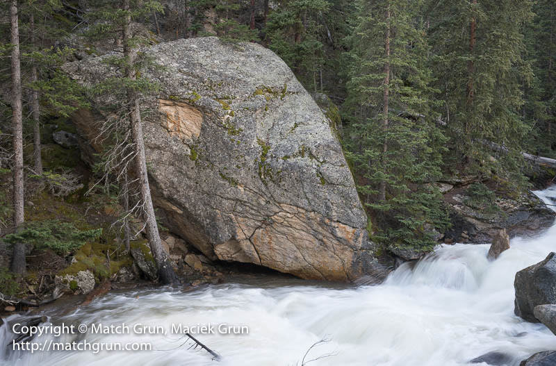
And then flows past this large boulder before heading down by the log bridge.
Boulder In South Clear Creek, Guanella Pass.
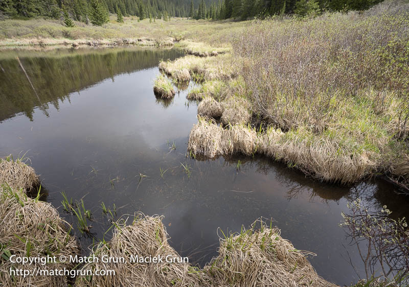
Higher up the pass, beavers have been busy over the years constructing dams
Beaver Dam On South Clear Creek.
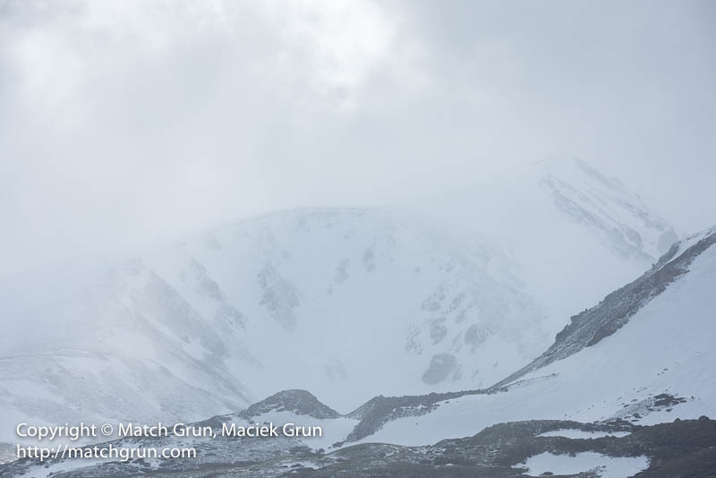
Over the summit of the pass, a snow storm was busy over Geneva Peak. During the course of the afternoon, the storm was busy dumping snow. At the roadside, there were occasional flurries, but it was not cold enough to stick to the roadway.
Summer Snow Storm Near Geneva Peak.
Farther down the pass, the Geneva Creek was full of snow melt.
Giant Boulder Along Geneva Creek.
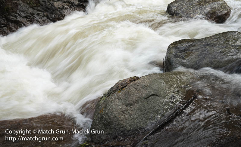
At this location, a few feet from the creek, the flow of the water was quite deafening!
Water Rushing Down Geneva Creek.
Apparently, we have not reached the peak of the snow melt!
For the last two weeks, many rivers in Colorado have filled due to snow-melt in the mountains. On Sunday, I headed out to Foxton, on the North Fork of the South Platte River, to make some photos of the river. The North Fork is fed from snow-melt and also water from a tunnel to the Dillon Reservoir. At this time of the year, the volume of flowing water can make for some great images. In this image, I used a long shutter speed to capture the flowing water.
Water Flow On North Fork Of South Platte.
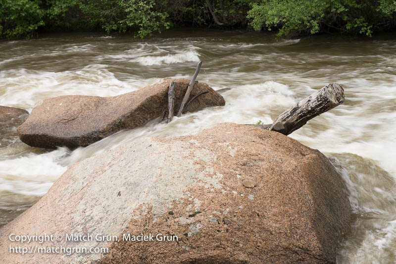
Typically, several logs, and other debris from the forests, in carried downstream, to get snagged in boulders and other obstacles in the river.
Logs, Trapped By Boulders.
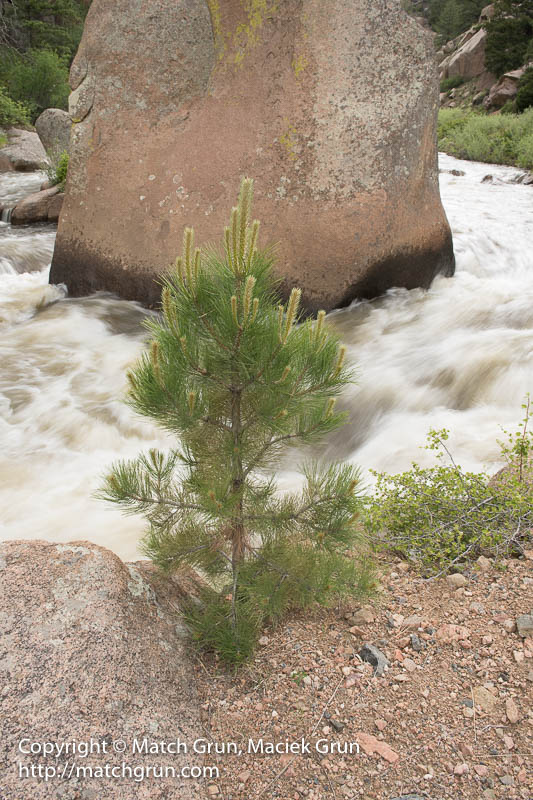
I found a location where water flowed around some of the larger boulders in the river. Some of these granite boulders measure some 12 to 15 feet in height. In this image, there was a pine sapling growing at the bank of the river. I carefully composed this image with the background boulder and sapling aligned and centered in the frame.
Pine Sapling At Bank Of Platte River.
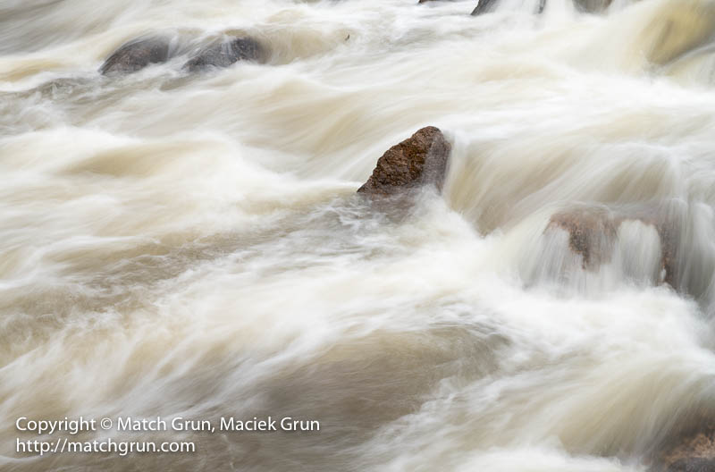
As the water flows downstream, it divides and flows around boulders. In this image, the water flowed over some low boulders, creating foamy turbulence around the larger boulder.
Turbulent Water Around Giant Boulder.
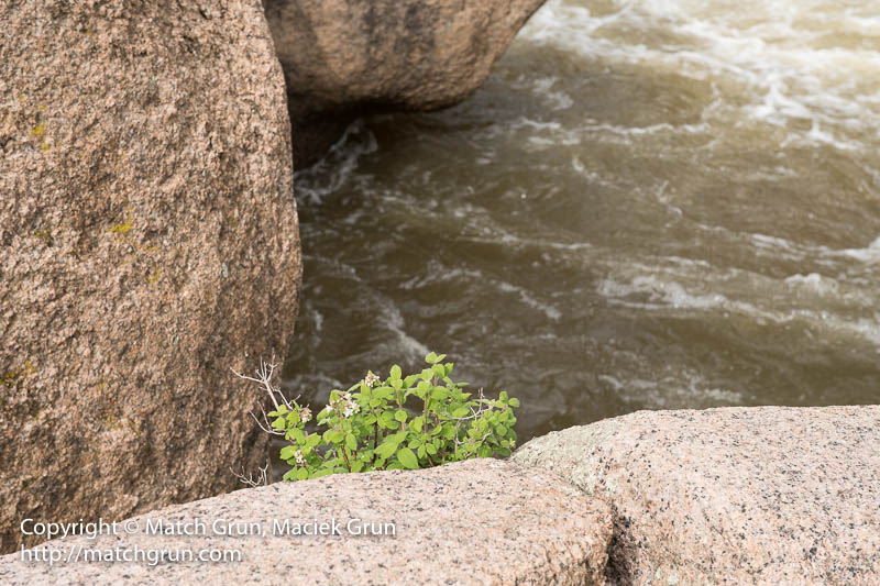
Moving downstream, I found a flowering place that was growing in a fracture running through pink granite.
Flowering Plant In Granite Boulder Crack.
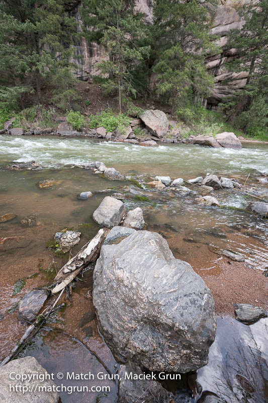
Farther downstream, is the confluence of the north and south forks of the river. The south fork did not have the huge water flow compared to the north fork.
Boulder In South Fork Of Platte River.
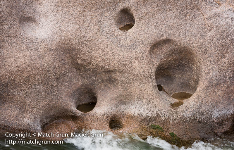
One location on the north fork has erosion pockets in the granite walls of a narrow canyon.
Erosion Pockets Along The South Fork.
For most of the late afternoon, the weather was overcast. This allowed for some great images without deep black shadow.
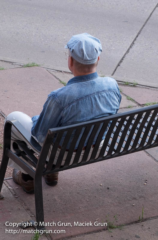
This last weekend, there were two art events. It was First Friday Art Walk and Art Student’s League Summer Market. After visiting one second floor gallery on Friday, I left walking down stairs and noticed one man sitting on the bench outside the gallery. This was an elderly gentleman who was watching the art scene all around him on Santa Fe Blvd. I made several images of him while people were walking past behind him. This was the best images without other distractions of passing people.
Watching The Art Scene Crowds.
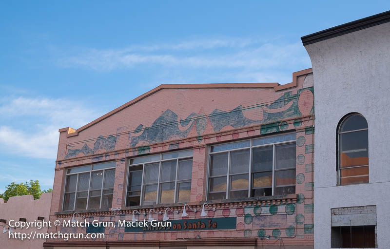
Across the street was the “Artists On Santa Fe” gallery was contrasted nicely against the late afternoon skies at sunset.
Artists On Santa Fe Gallery Building.
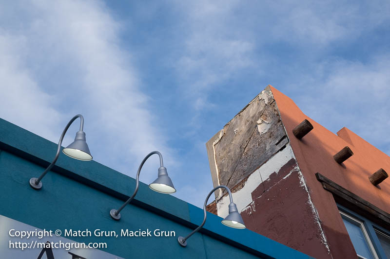
Looking up above me, the skies started to form some interesting patterns. The exterior lights had switched on to provide some light on the foreground building.
Three Lights And Sky, Santa Fe Blvd.
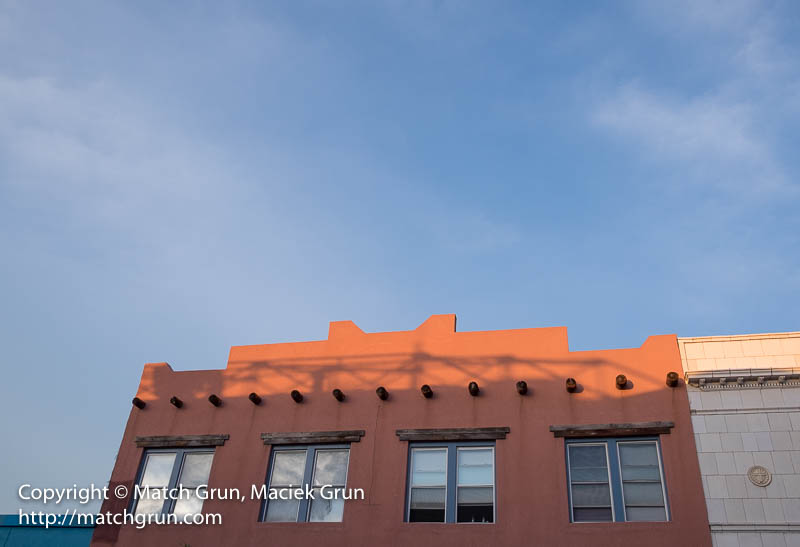
Later, after visiting some other galleries, the setting sun sank lower in the sky, creating shadows on the orange-brown facade.
Gallery Windows, Facade And Blue Sky.
Farther along the street, I noticed these four buildings with the sunset skies behind. The sunset was also reflected in the second floor windows.
Santa Fe Blvd Buildings And Skies At Sunset.
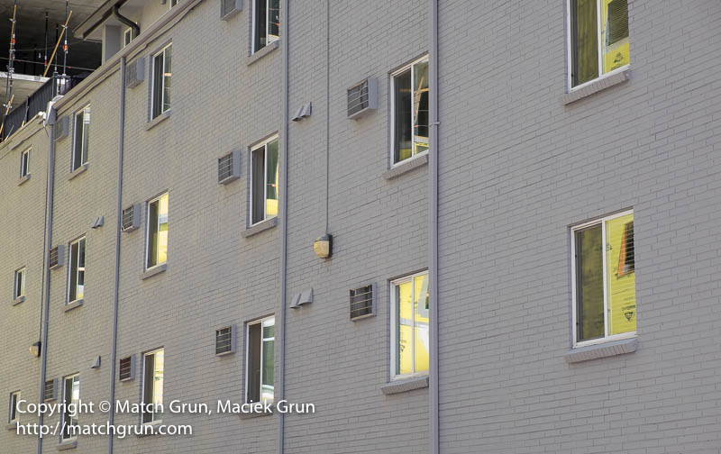
On Saturday, we took the opportunity to visit the annual Summer Market hosted by the Art Student’s League. This is a two-day event where Instructors and Student Members can display their art work for sale. Close to the League building are two sites where apartment blocks are under construction. The yellow cladding on the exterior of the new buildings was reflected from the adjacent building…
Yellow Construction Reflections.
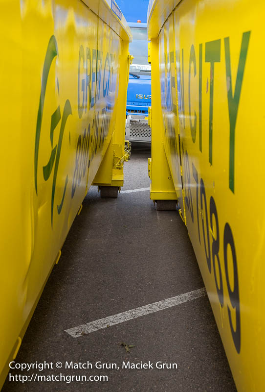
I noticed this yellow tunnel formed by two closely spaced dumpsters nearby. All that yellow, contrasting against that thin sliver of blue from the truck and sky in the background, just begged for an image!
Yellow Dumpster Tunnel.
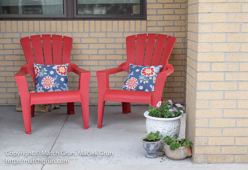
Finally, after departing the market, we passed these colorful red porch chairs.
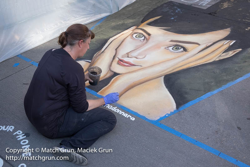
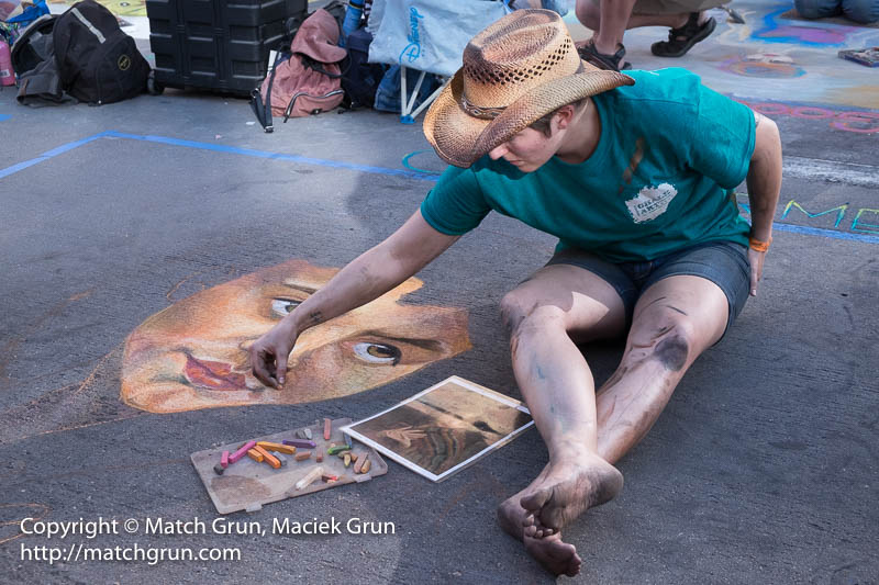
A few of the artists created 3-D art work. These works have been created to correct for the perspective. This requires the viewer stand at the front of the art piece at the designated view point marked on the pavement. Here is one image of Audrey Hepburn that the artist is completing.
Artist Working On Audrey Hepburn.
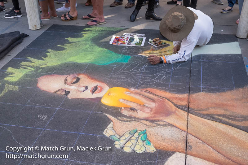
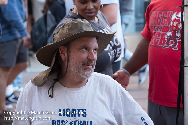
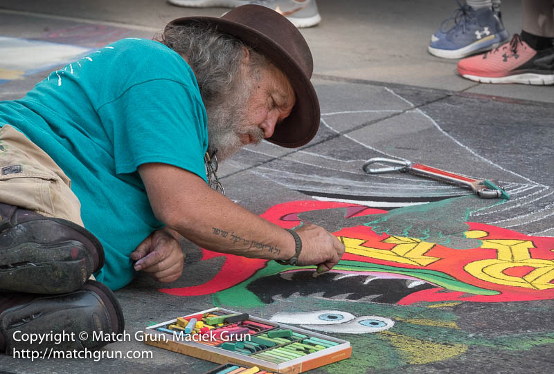
Here is one artist, who I have dubbed “The Gatekeeper”, busy at work.
The Gatekeeper, No 1.
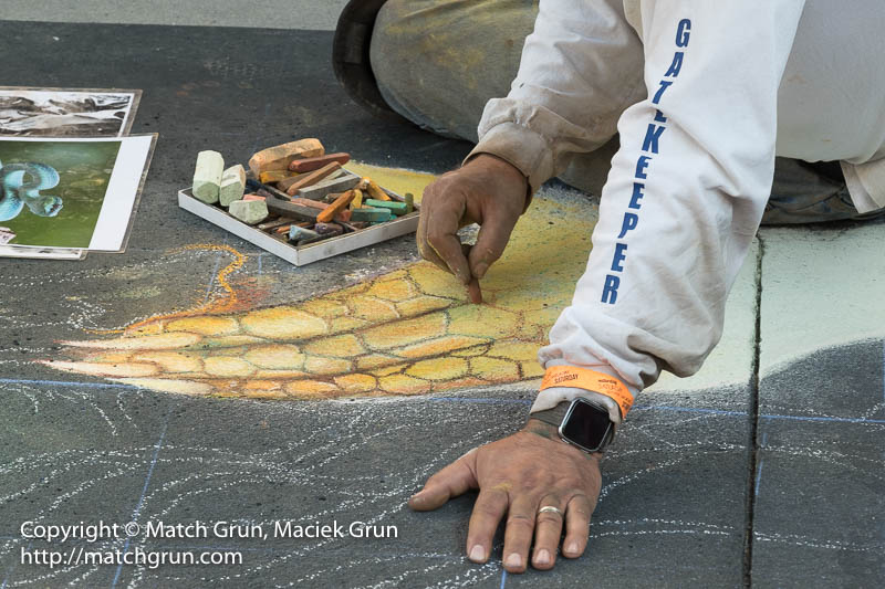
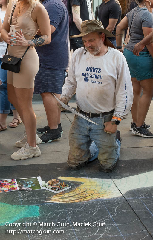
Here he is working some fine detail.
The Gatekeeper, No 2.
At last, the artist had to get uP; I could see his face and made this image as he was chatting to a bystander.
The Gatekeeper, No 4.
Checking on the perspective… And some more footwear!
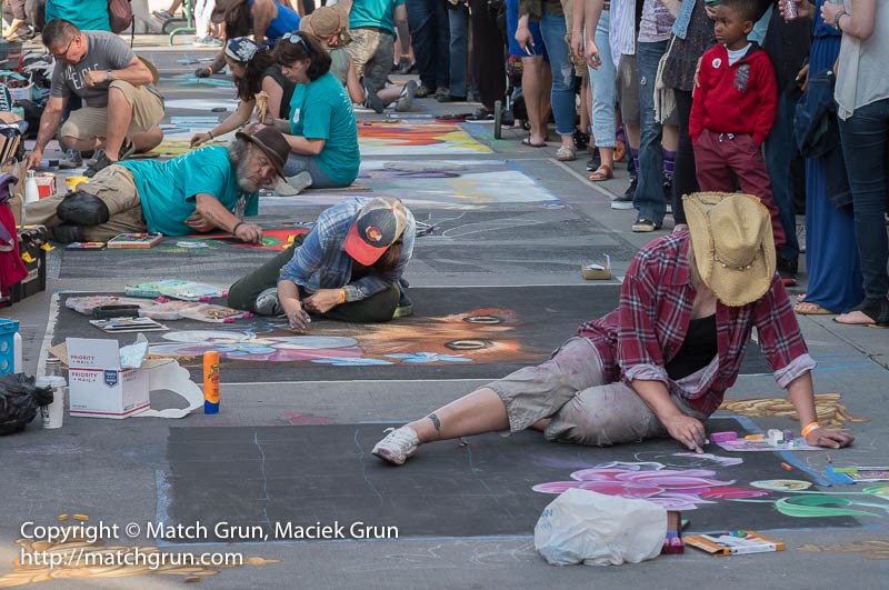
Later in the afternoon, the sun dipped down below the buildings, providing much needed shade for the artists. This is the image of the artists busy with their art works.
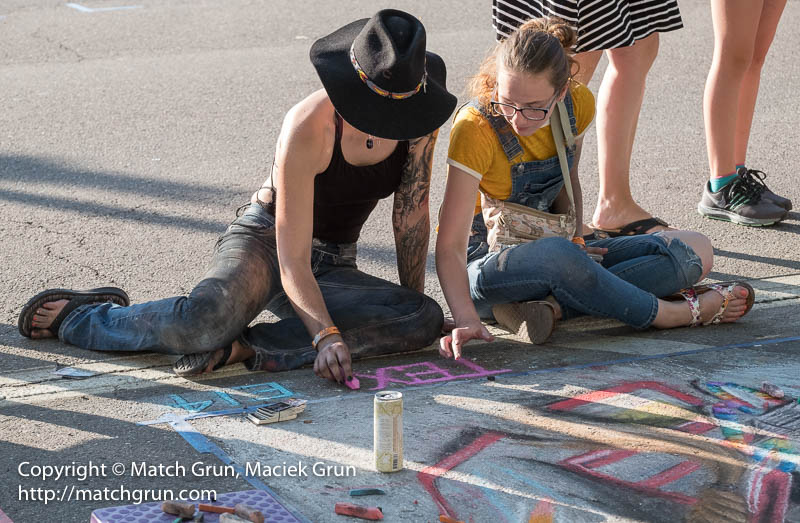
Larimer Street, Chalk Artists At Work.
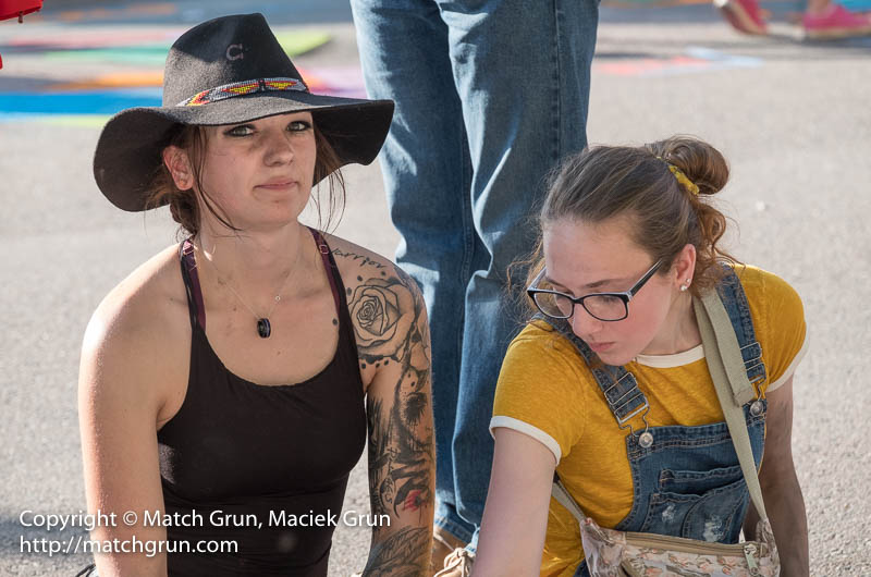
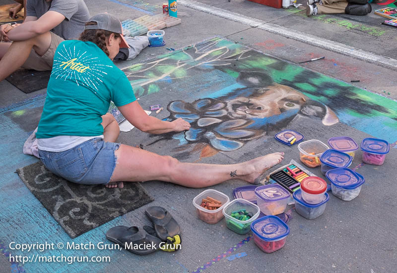
Here are some of the artists with their work.
Larimer Street, Chalk Artist No 1.
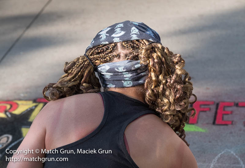
This artist was momentarily distracted before returning to his work.
Larimer Street, Chalk Artist No 2.
This image only caught my eye when picking out images to show. The lady in his image appears to be looking directly at the artist as he works on the image
Larimer Street, Chalk Artist No 3.
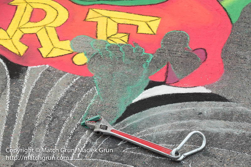
I made several images of this artist. That wrench behind him had jaws that were gripping the chalk.
Larimer Street, Chalk Artist No 4.
Wrench.
Jaws.
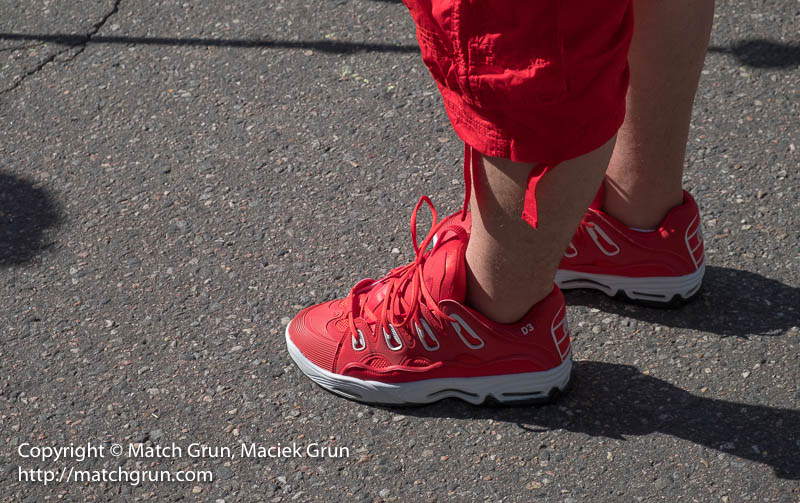
Pretty soon after start to make images of artists and their art on the pavement, one soon becomes aware of all the footwear that spectators are wearing. This one guy was wearing striking red shoes and red pants.
Chalk Arts, Footwear No 1.
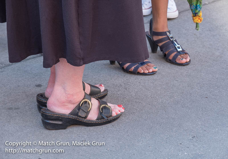
One also becomes aware of people’s feet, in the case of these two ladies with open toe shoes.
Chalk Arts, Footwear No 2.
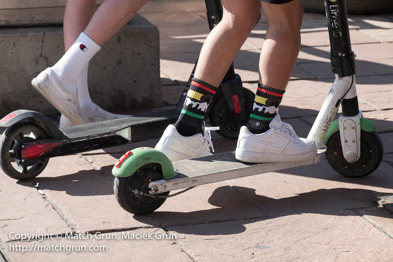
Some kids were also riding electric scooters.
Chalk Arts Footwear, On Scooters.
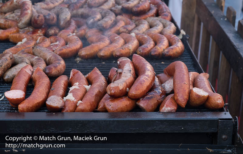
There was now shortage of food at the venue. Brats and other sausages were arrayed on the grill.
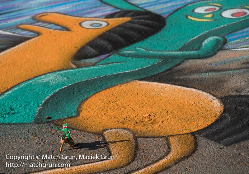
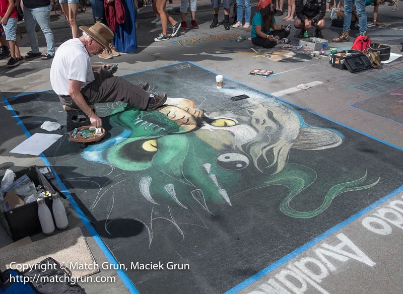
This weekend was the annual Chalk Arts Festival held in Larimer Street and adjacent streets. This artist was working on a piece sponsored by the Colorado Avalanche.
Colorado Avalanche, Artist No 1.
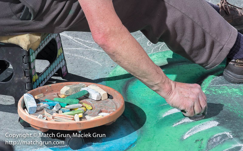
Here is a close-up shot of some of the detail of his image.
Colorado Avalanche, Artist No 3.
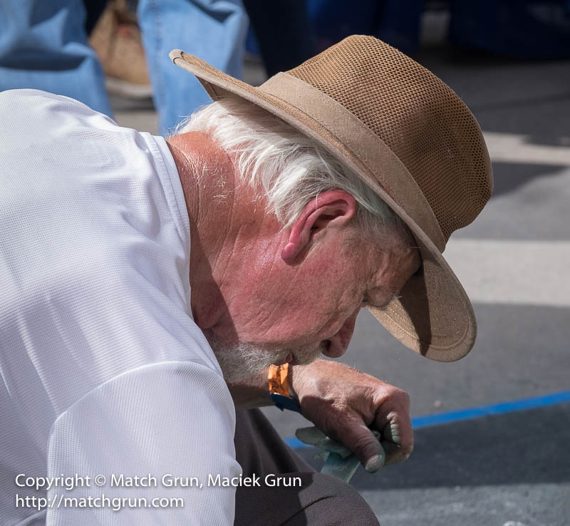
I like to capture some close up images of the artist himself.
Colorado Avalanche, Artist No 2.
The afternoon sun was very strong, that leads to some intense colors and deep shadows.
Chalk Arts, Painting The Detail, Color.
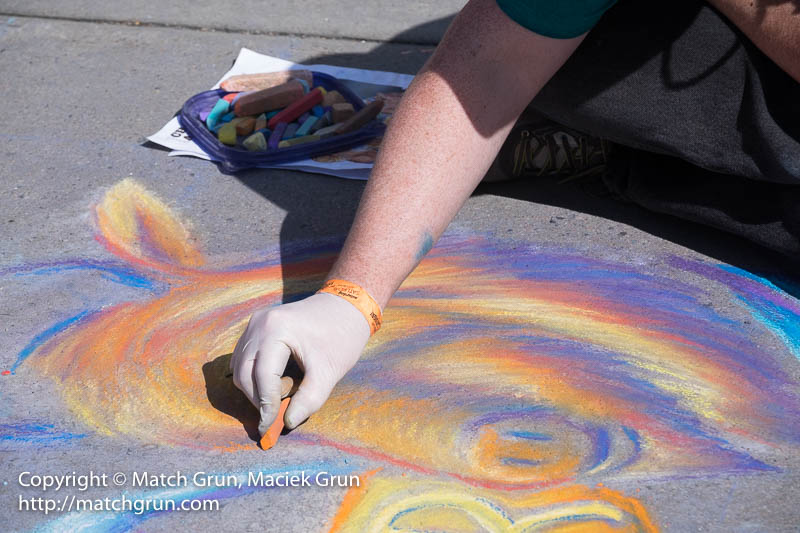
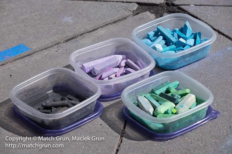
Some boxes full of chalk…
Chalk, In Boxes.
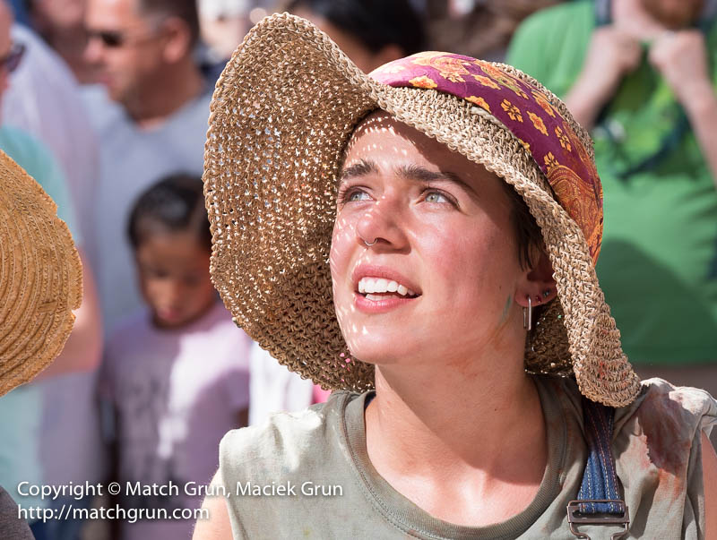
The afternoon sun was shining directly into the street. Also, light was reflected of nearby office building windows. This young lady was obviously feeling the heat, but I could not resist making an image of her pretty face.
Young Artist.
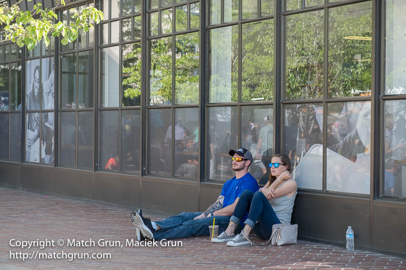
This couple were found taking a break from the sun in the shade.
Taking A Break From The Sun.
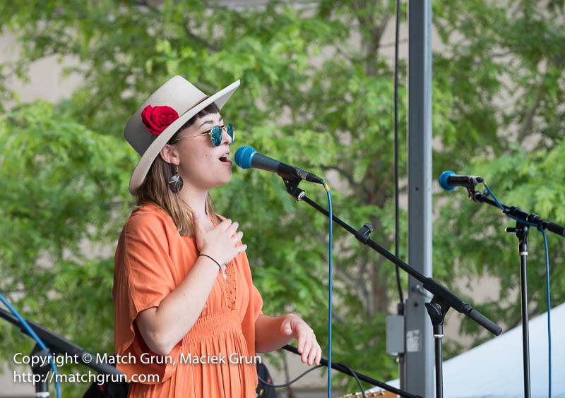
Entertainment was provided by a jazz band, “Sol Burial”
Sol Burial, Vocalist.
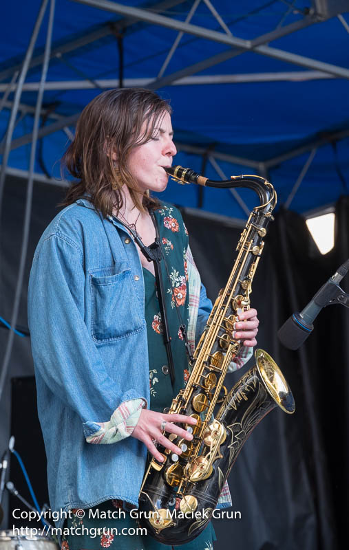
Their sax player played some really awesome saxophone solos during their final set on the stage.
Sol Burial, Sax Player.
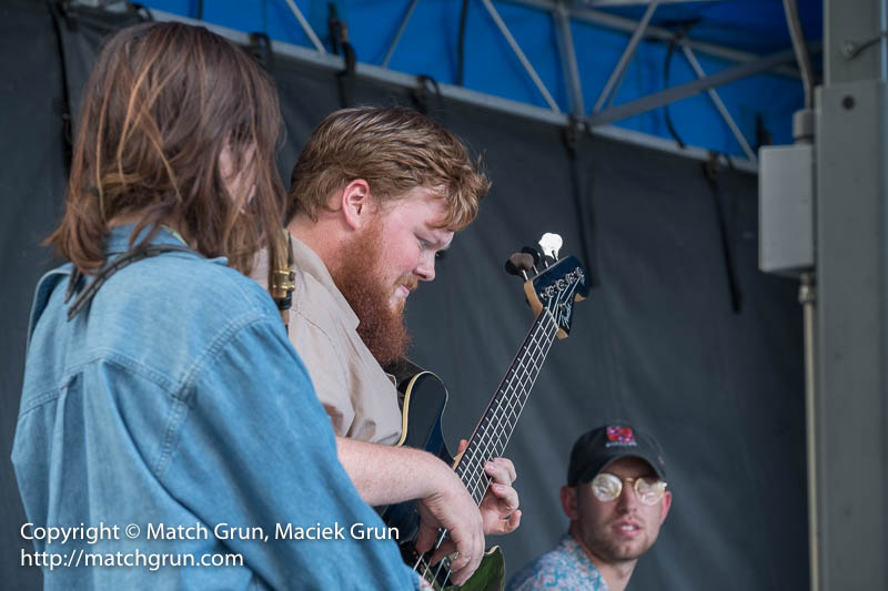
Here is the bass player soloing, while the drummer and sax player look on.