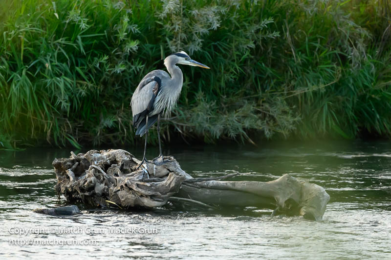
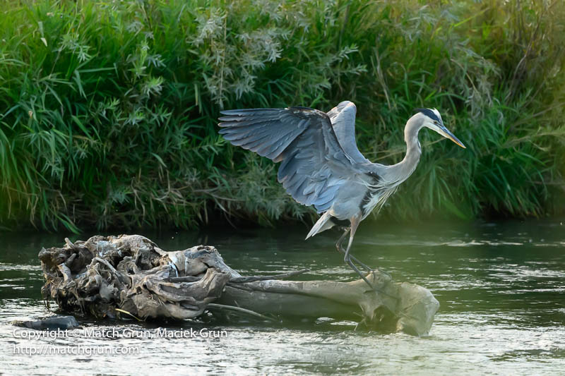
Yesterday afternoon, we headed down to Reynold’s Landing on the South Platte River, hoping to do some birding after watching the football game. It was pretty quiet along the river, with maybe 3 groups of people tubing down the river. We spotted the usual night herons and snowy egret. After most of the tubers had passed, we spotted a Great Blue Heron. I had been wanting to capture some different behavior of this fabulous bird. So I just waited to see what happened. The heron was perched or a log, gazing up an down the river.
Great Blue Heron Sequence, No. 1.
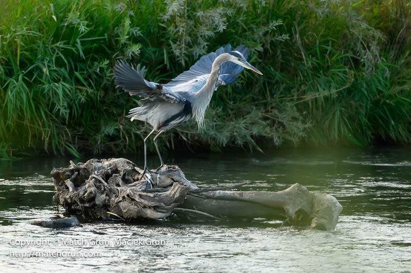
All of a sudden, the heron appeared to take flight.
Great Blue Heron Sequence, No. 2.
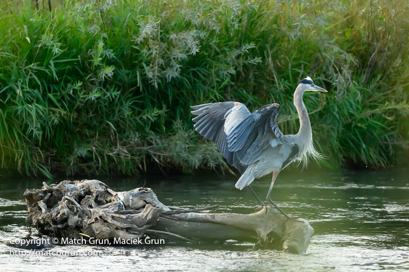
But it was just one big hop…
Great Blue Heron Sequence, No. 3.
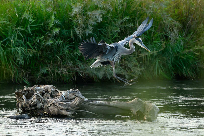
To the other end of the log!
Great Blue Heron Sequence, No. 4.
And then landing.
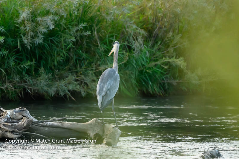
Great Blue Heron Sequence, No. 5.
To resume gazing downstream!
Great Blue Heron Sequence, No. 6.
Even though we spent just over an hour at the river, we had fun watching just a few birds. The Great Blue made my day!
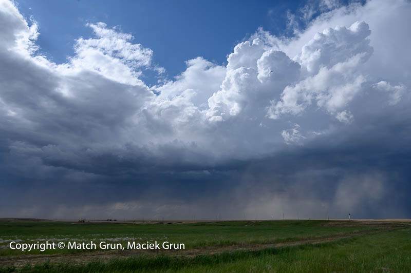
May was one of the rainiest months of the year, with huge storms over the Eastern Plains. Last Saturday, the sky was full of storm clouds, so I headed out to Bennett. I captured this image north of Bennett; this is close to the flight path out of the DIA airport. You may even spot an airplane in front of one huge clouds in this image.
Storm North Of Bennett.
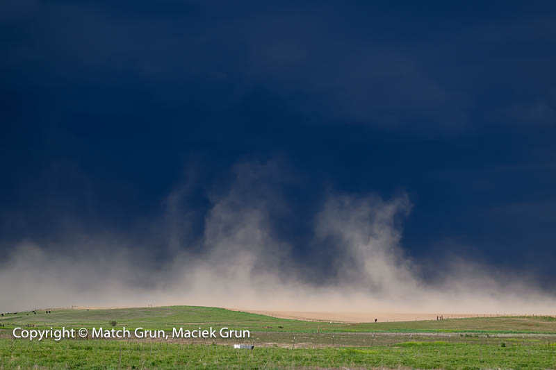
Soon I headed east, so I could return to Bennett. Along the roadside, the strong winds kicked up a dust-storm on one of the plowed fields. This was spectacular against the dark clouds.
Dust Storm On Agricultural Fields, Near Bennett.
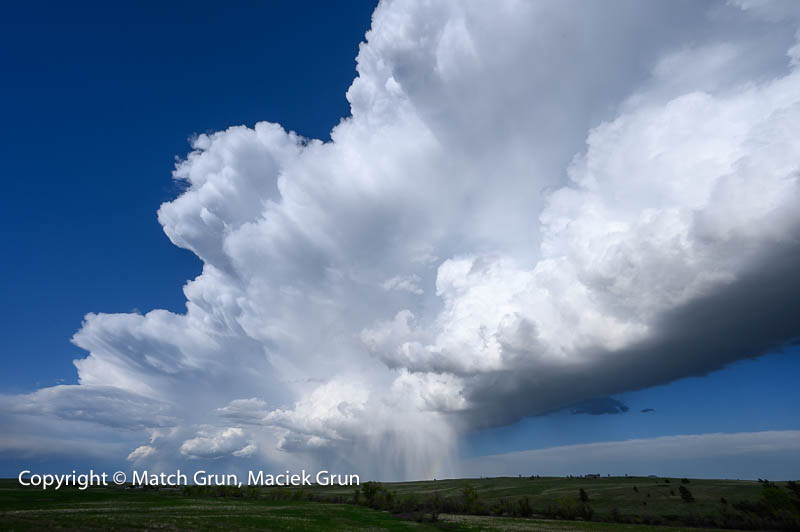
From here, I headed south, through Bennett and then to Kiowa. South of Kiowa, I found another huge storm cloud that stretched all the way from Colorado Springs to Bennett, against a deep blue sky.
Storm Clouds from Colorado To Bennett.
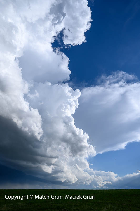
This next image that showed the full height of the storm above me.
Storm Clouds Colorado Springs To Bennett.
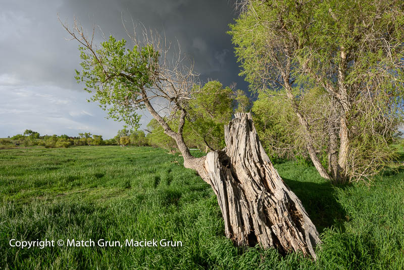
Soon it was time to turn back. Across the road where I had parked, was this half-dead tree in front of a roadside pond. This was lit up by the late afternoon sun, just before becoming obscured by clouds.
Half Dead Tree Under Storm Clouds.
Fortunately, I was able to make this image, with the trees and fresh spring grasses, against a storm laden sky.
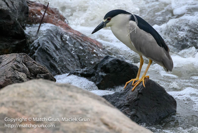
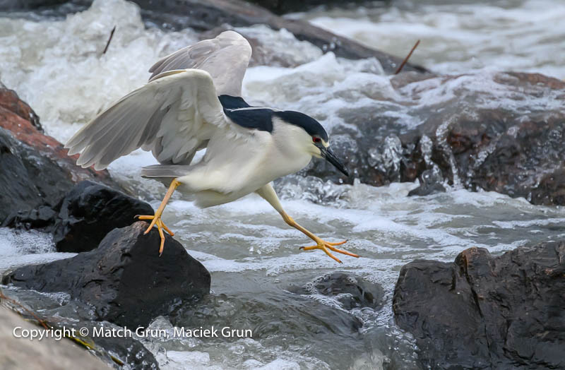
While out daughter Susan was visiting us, the two of us took a trip to the South Platte river to see what birds we could find. After finding a Night Heron, she became entranced by these birds fishing among the rocks. It turned out that there were 5 Black-Crowned Night Herons spread out across the width of the river! What luck. We spent most of the next hour watching these herons as the they were fishing.
Black-Crowned Night Heron. South Platte.
These birds are really amazing to watch. Look as those bulging eyes that I managed to capture in the following image.
Night Heron, Hunting, South Platte.
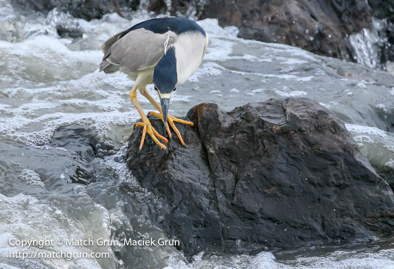
This was the heron closest to where were sitting close to the bank of the river. Soon the heron spread its wings an did some rock hopping to move to a new location.
Night Heron, Rock Hopping.
Here the heron continued fishing. Success at last, as it caught something from the river! Susan saw several herons catching some prey. I only managed to get one decent image, with the heron swallowing prey.
Night Heron, Caught Some Prey.
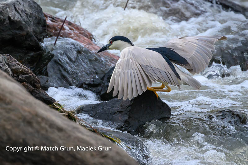
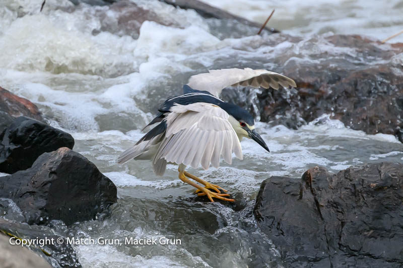
After munching on the food, this heron did some rock hopping. I captured this heron in mid-stride.
Night Heron, Mid-Stride, No 1.
Here is the next image in mid-stride.
Night Heron, Mid-Stride, No 2.
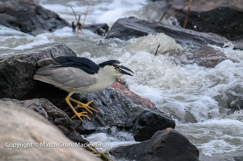
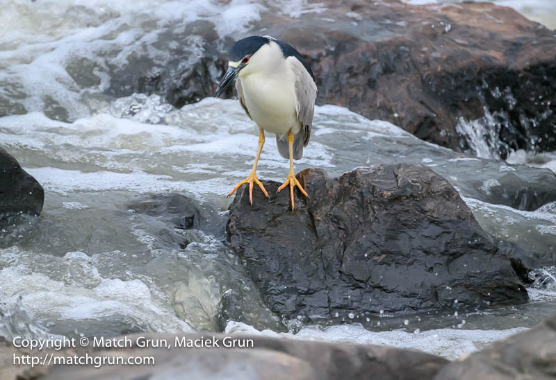
Finally, this heron resumed fishing from the next rock!
Night Heron, Resume Fishing, South Platte.
We both enjoyed the time spent observing these herons as they went about hunting for fish and other critters swimming in the Platte River.
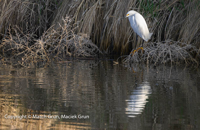
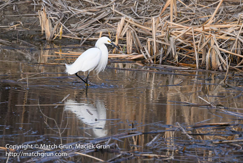
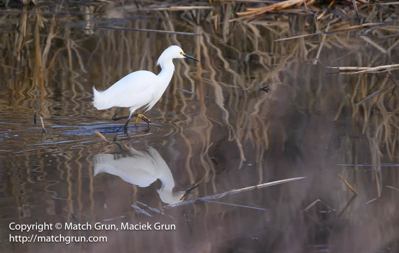
Last week, I headed out to Westerly Creek to checkout the latest arrivals. From the parking area, I headed down to the creek and across the bridge where Westerly Creek meets up with the Sand Creek. Here were the usual birds that I had been seeing during the last month, including Robins, Widgeons and Mallards. After I had turned back, two Snowy Egrets landed in the creek. I managed to make an image of one egret who was visible on the far bank.
Snowy Egret, Sand Creek.
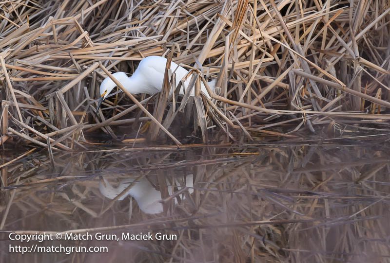
After returning to the parking area, I headed to another location along Westerly Creek, where there is a pond alongside the creek. Having spotted an egret in the pond, I made my way down to the pond. When fishing (or hunting), Snowy Egrets typically stir up the floor of a pond, hoping to dislodge some live tasty food!
Snowy Egret, Stirring Pond Westerly Creek.
In the image above, the bubbles below the egret above, were caused by the egret when stirring up the floor of the pond. After finding a tasty morsel, this egret soon decided to investigate the cattails along the far bank of the pond.
Snowy Egret In Cattails Westerly Creek.
After a while, this egret returned towards the center of the pond.
Snowy Egret Wading Westerly Creek, No 1.
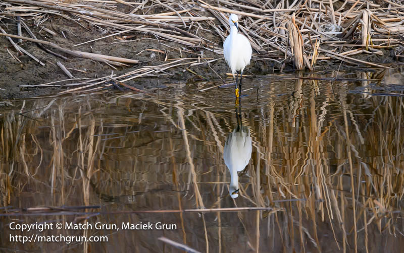
I soon learned that there was a second egret located on my side of the pond. The second egret was obscured by the cattails in front of me.
Snowy Egret Wading Westerly Creek, No 2.
Here is another image of the same egret. Snowy Egrets can easily be identified — they have yellow feet or “yellow slippers”.
Snowy Egret Hunting Westerly Creek.
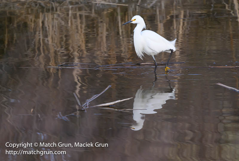
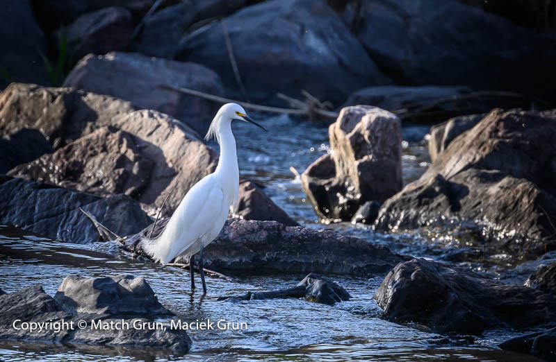
This afternoon we headed out to the South Platte River. After walking south from the parking lot we heard many birds, but they proved difficult to find. We head back, and then continued north. What luck, we found a Snowy Egret at the weir.
Earlier this month, we took a birding trip to Monte Vista. Every year, at this time of year, Sandhill Cranes make their way north to their summer breeding areas. Monte Vista is one location where thousands of cranes stop over during their flight from New Mexico.
The city also hosts an annual Crane Festival. This year we decided to visit before the festival started. It was the 40th anniversary of the festival, so we chose to avoid the expected crowds.
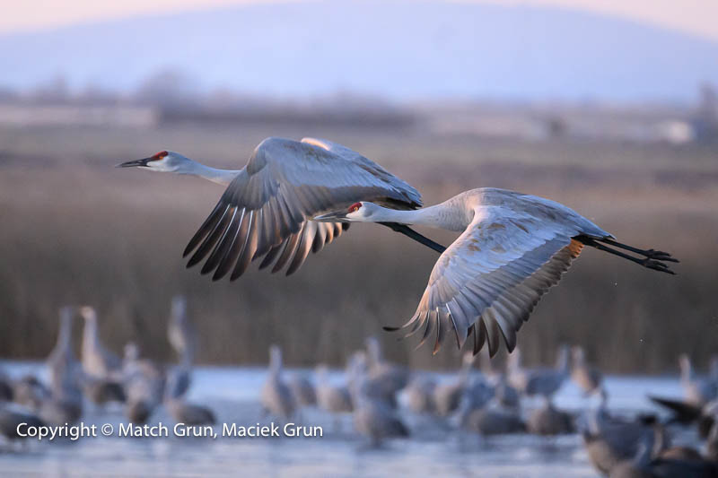
For our first morning, we headed out to the National Wildlife Refuge at dawn, well before sunrise.
Pair Of Sandhill Cranes, Taking Flight, Monte Vista.
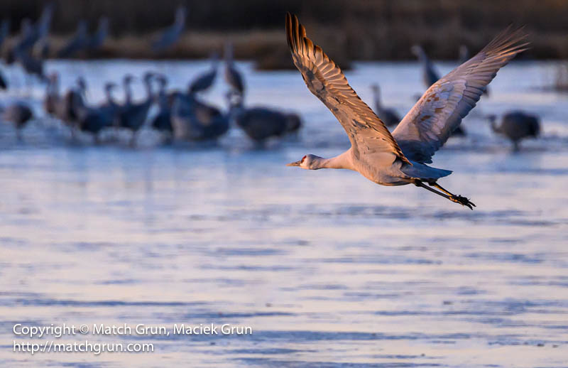
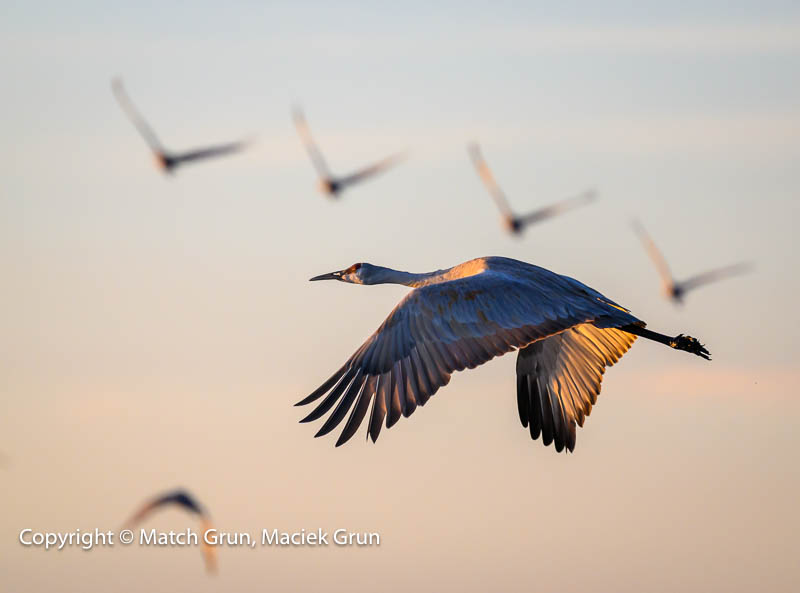
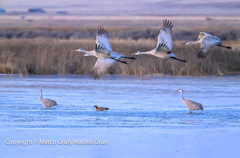
The cranes spend the night in the the ponds, where they are safe from any predators. Hundreds of Canada Geese also spend the night in the same ponds. About the time of sunrise, the take flight, either singly or in family groups, to daily feeding grounds. I managed to capture some of these magnificent birds in flight.
Sandhill Crane In Flight, Monte Vista Ponds.
In the following image, the single crane took flight. In the background there are five cranes — all out of focus. I like the contrast of the four out-of-focus birds with the wings swept up above the single bird, contrasting with the wings swept down of the out-of-focus single bird.
Single Sandhill Crane At Sunrise.
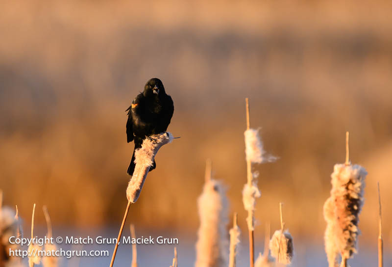
Around the edges of the ponds are plenty of cattails. Hundreds of Red-Winged Blackbirds also spent the night in these cattails. There was an amazing cacophony of sound as the birds were chattering and calling from the cattails.
Male Red-Winged Blackbird, Calling, On Cattails.
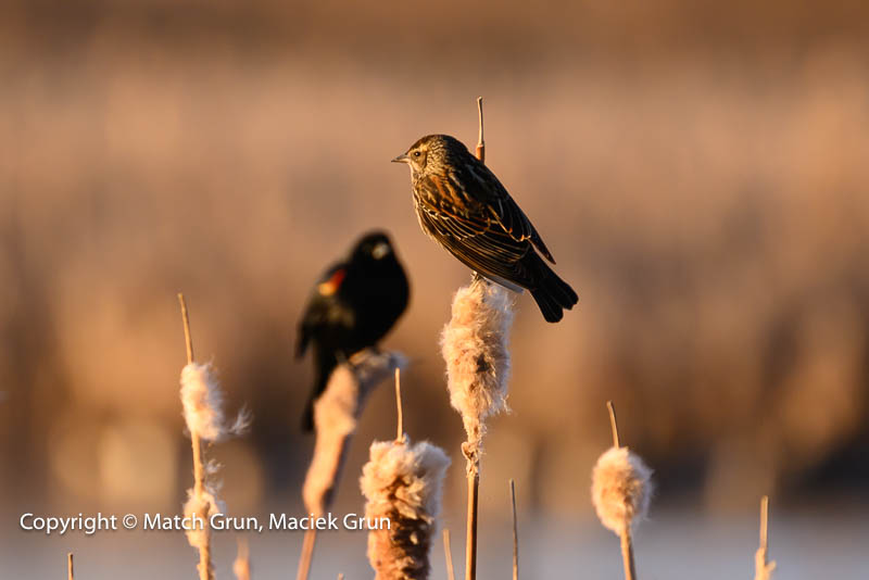
Typically, there are male blackbirds that have migrated to the ponds, while they await female birds to arrive. I did manage to find one female Red-Winged Blackbird, perched on a cattail.
Female Red-Winged Blackbird, Monte Vista.
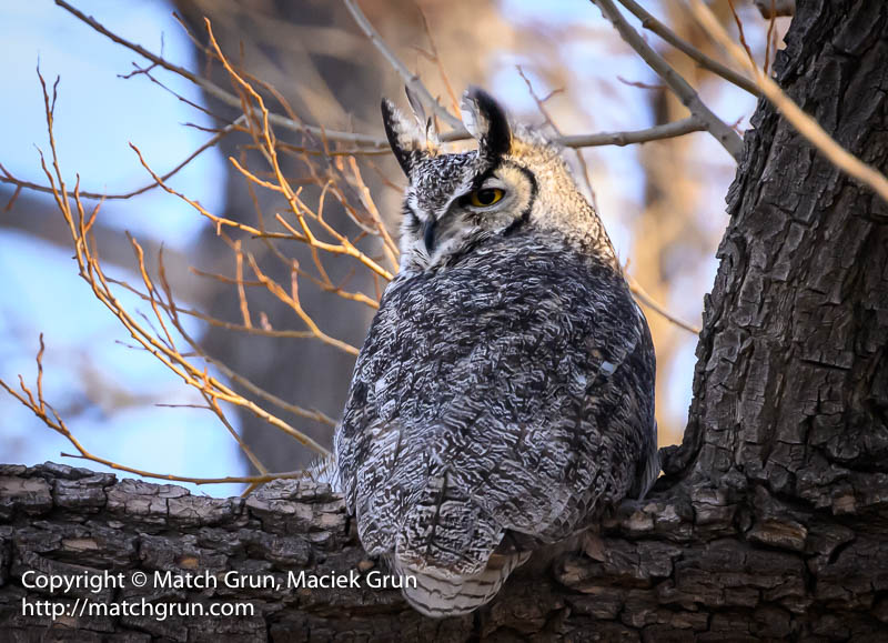
This year we were lucky in finding a male Great-Horned owl during the late afternoon. They are really difficult to see clearly because they often perch close to the main tree trunk and are often tucked between other branches. Luckily, this owl was perched in a tree close to the road. They may also roost in trees far from the roads during the day. They are so well camouflaged that they become invisible.
Great Horned Owl, Monte Vista NWR.
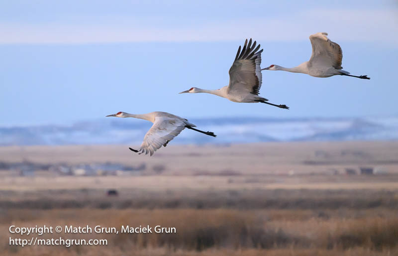
During the other mornings, we headed out well before sunrise. Here are some more images of family groups of Sandhill Cranes leaving the ponds.
Sandhill Crane Family, Taking Flight.
And here is a family threesome taking flight against the dawn sky.
Three Sandhill Cranes, Monte Vista NWR.
We spent three nights and four days in Monte vista. However, for days two and three, there were strong cold winds blowing across the San Luis Valley, often kicking up dust from the dirt roads and ploughed fields. Regardless, we still enjoyed birding for all four days.
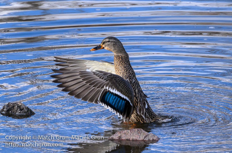
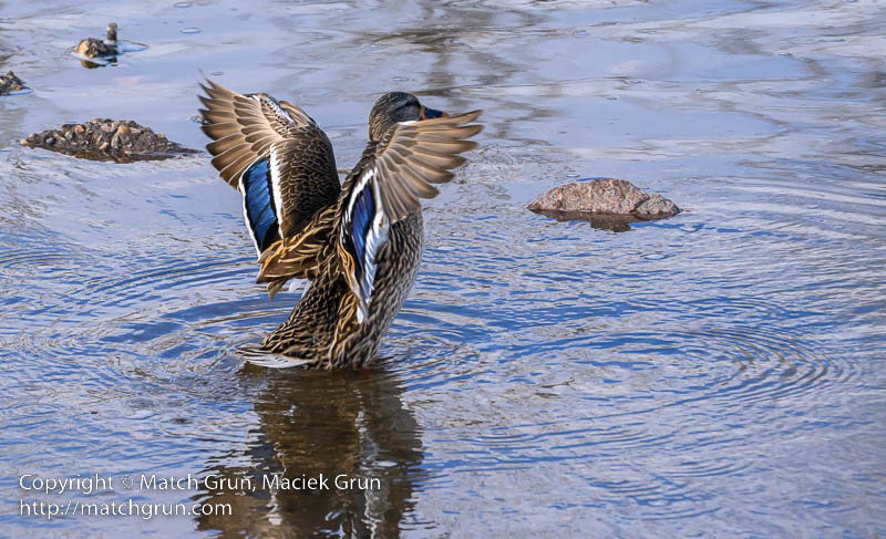
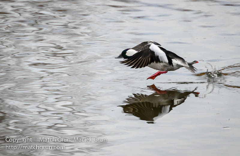
Winter is always a good time to view ducks and other waterbirds along the South Platte River. Now for something a little different. Mallards and Canada Geese are really plentiful species along the river. As a result, I don’t usually make photographs of these birds. However, this month I did find one female Mallard that was preening herself and flapping her wings at the riverside. I could not resist making some images of this one individual duck.
Female Mallard Swept Wing No 1, South Platte.
Those blue tail feathers are really striking in the above image. Here is another image with swept back wings.
Female Mallard Swept Wing No 2, South Platte.
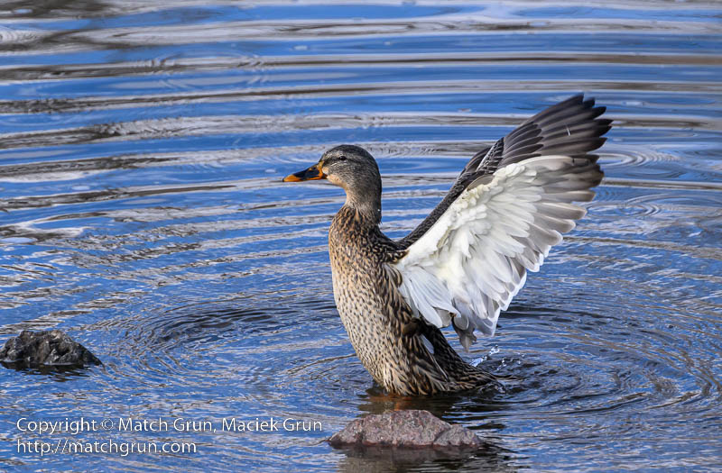
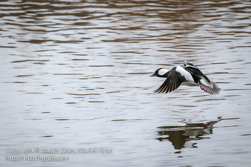
Here is another image that shows equally spectacular wing detail of this magnificent bird.
Female Mallard Flapping Wings, South Platte.
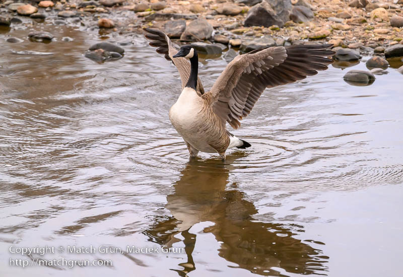
On another morning, I found this Canada Goose that was flapping its wings while standing in the water. This might prove interesting. There were several geese in the area, so I may get lucky to catch some geese in flight.
Canada Goose Flapping Wings, South Platte.
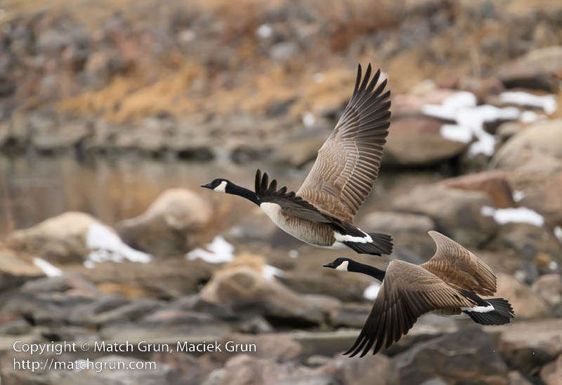
Sure enough, the flock of geese took flight. I managed to capture a whole sequence of images. Here is the leading pair of geese taking flight.
Canada Geese Taking Flight, South Platte.
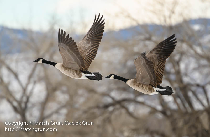
I continued tracking the geese, with this one being the last in the sequence.
Canada Geese In Flight, South Platte.
Later that morning, I was watching a male Buffelhead duck in the river, when he suddenly decided to take flight. These are small ducks, so the move very fast. Here is an image soon after he leaves the water, paddling with his feet.
Buffelhead Duck Taking Flight, South Platte.
A few moments later, he had successful taken flight. Here is one image as he was fully out of the water.
Buffelhead Duck In Flight, South Platte.
It is always a challenge to capture images of birds in flight. So I was happy with these few images from this month.
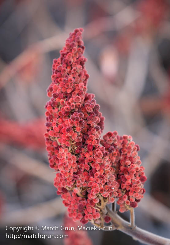
At this time of year, I usually take a walk through the neighborhood, usually in the evening after work, and sometimes at the weekend. Last weekend I chose a different route, where a bridge crosses one of the local “ditches”. Close by, there are several large sumac bushes that we covered with bright red berries.
Sumac Berries In Winter.
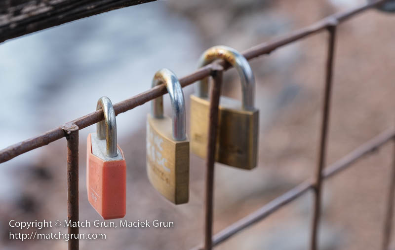
Crossing the bridge, there is a collection of love locks attached to the bridge. That red lock just grabbed my attention, so I made this image of a cluster of three locks.
Love Locks On Neighborhood Bridge.
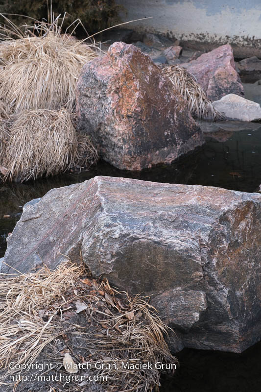
The route continued through the hospital and then to Harvard Gulch Park. Sometimes, I head down to the stream that flows though the gulch. Here that are some interesting rocks that have pink and gray coloring.
Rocks In Harvard Gulc
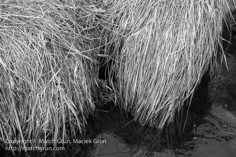
The edges of the gulch are covered with long grasses that reach down to the water’s edge. During the winter, these grasses, turn pale yellow and make a great monochromatic image.
Winter Grasses Along Harvard Gulch.
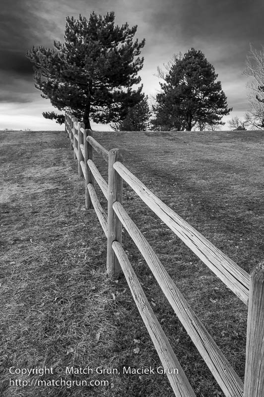
The park is separated from a golf course by this long fence. Looking up the fence, there was a hint of blue sky behind mostly overcast skies. Another candidate for a black and white image.
Fence Along Harvard Gulch Park.
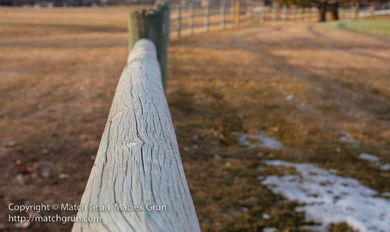
Reaching the top of the fence, I decided to shoot another image as the fence curved to the right.
Park On The Left, Golf To The Right.
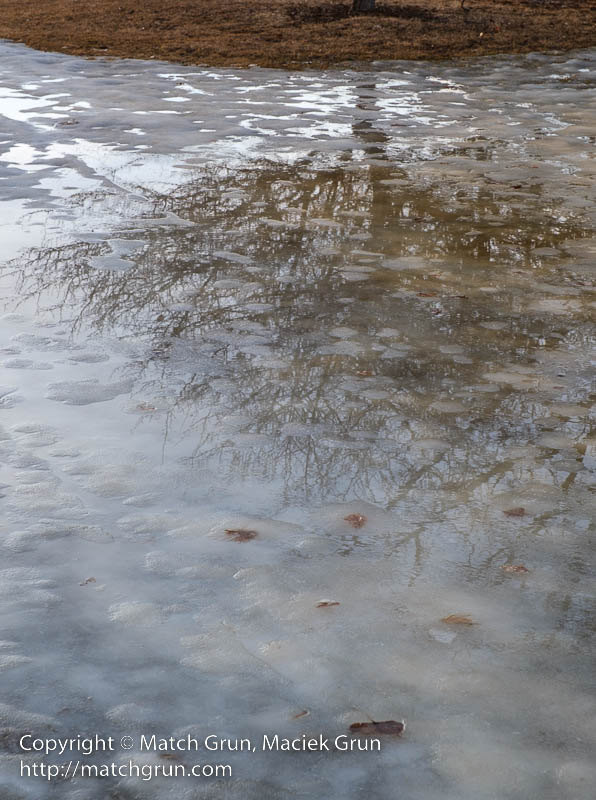
From here, I headed across the park. Close the the far edge, was a huge patch of snow and ice, that had been melting during the course for the day, forming a pool of water and ice. Gaps in the ice, where water had melted, allowed nearby trees to be reflected in the pool.
Icy Tree Reflections, Harvard Gulch Park.
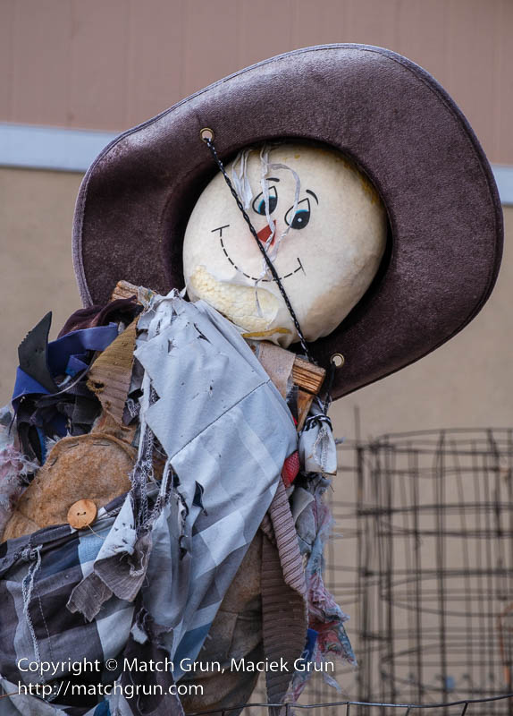
Sometimes I take a detour through one of the alleys. In one of these alleys is this colorful scarecrow.
Scarecrow In The Alley.
It was close the sunset, so that was the last image of the day.
This winter, we have had several snow storms in the Denver area, with the mountains receiving even more storms. A couple of weeks ago, I decided to head into the mountains, near South Park, where I hoped to experience some storm action! Heading out on highway 285, as I approached Bailey, the storm was dumping snow on the mountains south of the town. I left the highway to find a location above the town that offered a clear view to the south. The soft filtered sun lit up some snow clouds in the valleys to the south.
Winter Storm Near Bailey.
Rejoining the highway, I headed up Kenosha Pass and on towards to South Park. At Como, I left the highway to join the dirt road that leads to Boreas Pass. At this point, there was some clearing of the clouds that allowed the blue sky to peek through. Stopping there, I made the following image.
Winter Storm At Como.
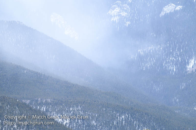
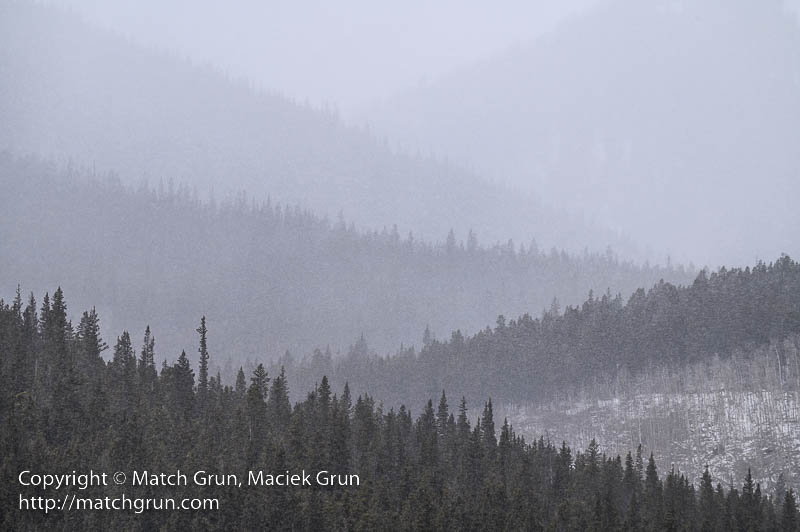
For grins, I decided to head towards Boreas Pass for some more exploration. At the base of the pass, the road was closed for the season — typically this would be from November through to May. Boreas Pass was once the route of the narrow gauge railroad that connected the mountain mining town of Breckenridge to Como. Stopping at the roadside, I made this image. The falling snow progressive reduces visibility into the distance. This results in a nice layering of the mountain ridges receding into the distance.
Snow Storm At Weston Pass.
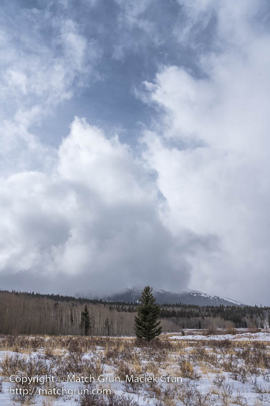
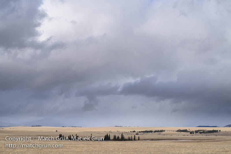
Heading back, I rejoined highway 285 and headed south. There are large areas of South Park that did not have snow covering the ground. The mountain grasslands had turned into a pale yellow, as in this image. It was great to see the contrast between the yellows and blues whenever a patch of blue sky opened up in the clouds overhead.
Storm Over South Park.
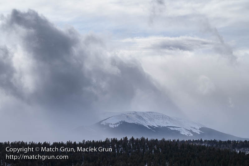
Looking back towards the west, a snow storm was raging near Weston Pass.
Storm Brewing Near Weston Pass.
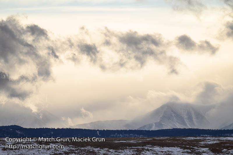
Soon it was time to head back. I made my way towards Hartsel and Fairplay. Along the road was a sign to Tomahawk State Wildlife Area, that is located on a ridge above the park. This needed some more exploration, so I headed up the dirt road. By this time the sun was getting low, close to sunset. From this location, I could make out the Collegiate Peaks in the far distance. A the sun dropped lower in the sky, the clouds started turning yellow from the setting sun.
Storm Over Collegiate Peaks.
A few minutes later I started to head back. From this point, I was driving in light to heavy snow for most of the journey home.